30 تغريدة 5 قراءة Dec 23, 2024
I love maps, you love maps, everybody loves maps... prove me wrong 🧵
1. Topography of USA x.com
2. A map of the world but it’s just the time zones. x.com
3. Population Density of Africa x.com
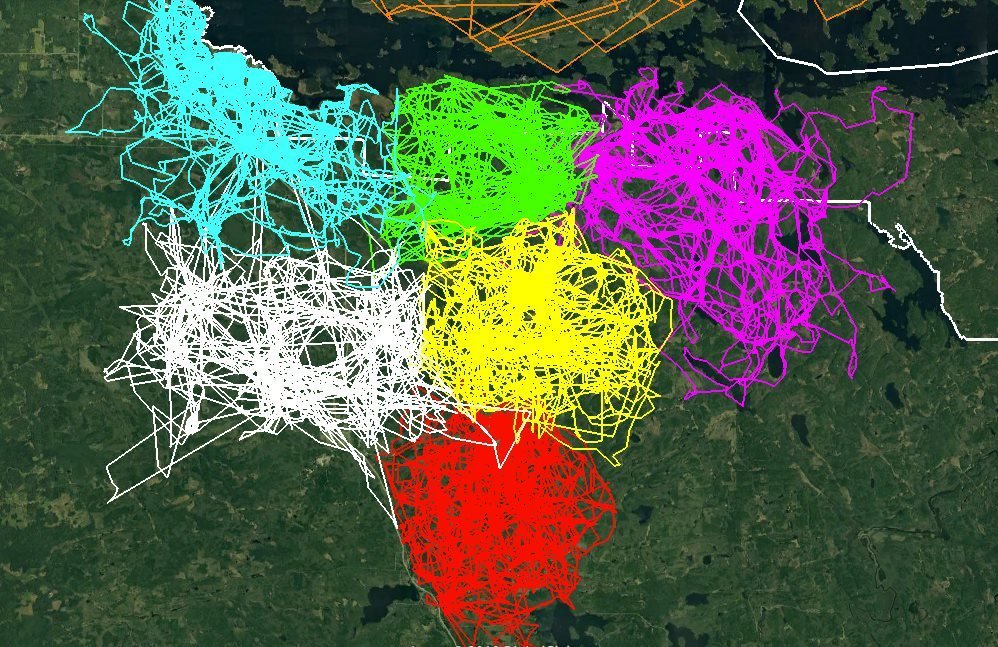
4. An image of GPS tracking of multiple wolves in six different packs around Voyageurs National Park shows how much the wolf packs avoid each other's range. x.com
5. Every dot is a football (soccer) pitch x.com
6. The oldest universities in continuous operation x.com
7. How close South Korea came to losing the war
x.com
8. World map according to Google Street View x.com
9. Australia's Population Density x.com
10. The real size of Africa x.com
11. light blue is a map as we know it and dark blue is the actual size of each country x.com
12. Neitokainen is a body of water in Finland, which is shaped like Finland x.com
13. Europe in 1444 x.com
14. South America elevation tile map x.com
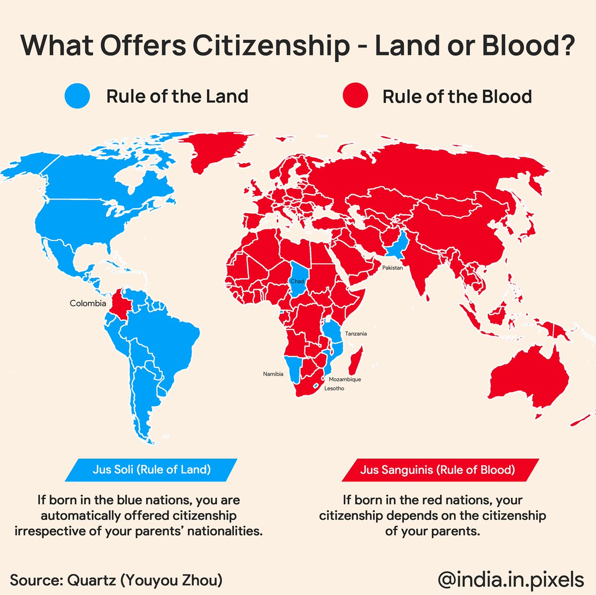
15. Places where birthright Citizenship is based on land and places where it is based on blood x.com
16. Interactive Topography Sandbox
x.com
17. Italian Pasta Map x.com
18. Pangea, the supercontinent that existed around 300 million years ago, shown with the borders of modern countries. x.com
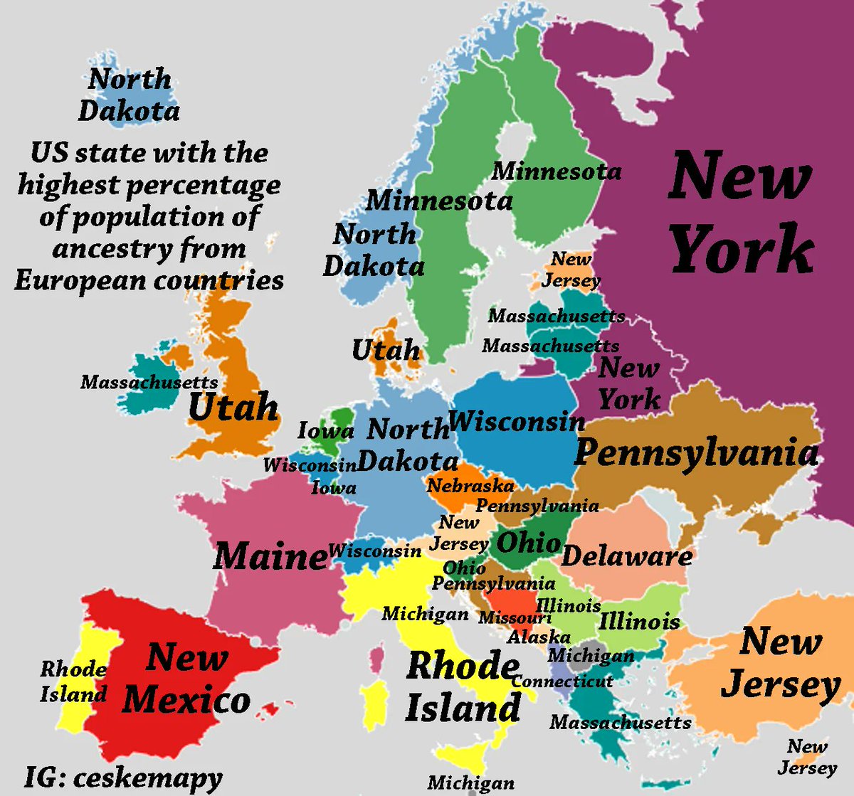
19. In which state you can find the highest percentage of people with ancestry from every European country x.com
20. These three regions make up 50% of world GDP x.com
21. An Interesting Fact About Russia and USA x.com
22. It's super long x.com
23. Is there a reason why this group of countries end their names with “stan”? x.com
24. The true size of New Guinea x.com
25. Japan is farther east, west, north and south than Korea x.com
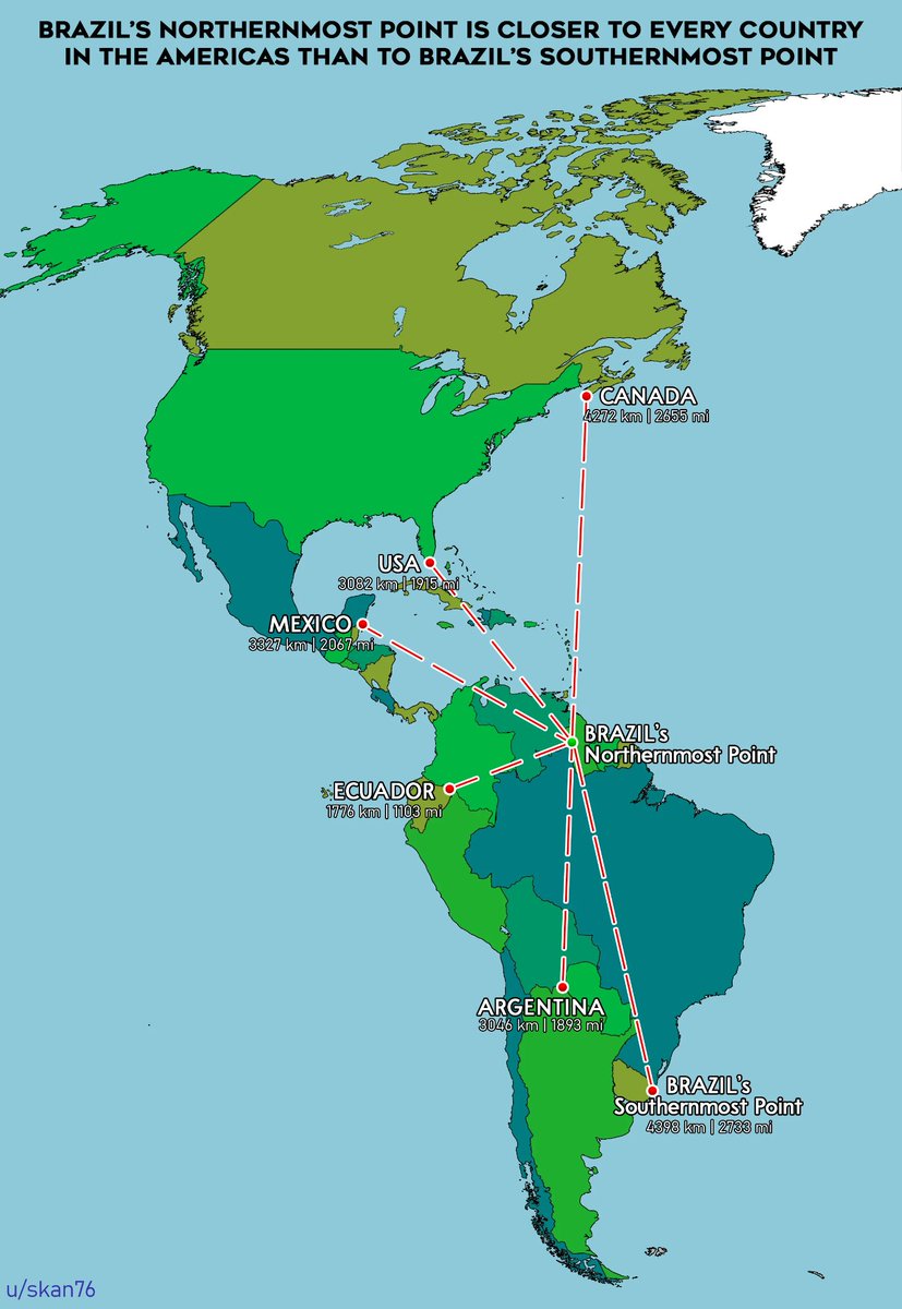
26. Brazil's northernmost point is closer to every country in the Americas than to Brazil's southernmost point x.com
27. What pedestrans look like across Europe x.com
28. The world according to fish (Elastic II projection) x.com
29. Which countries have capybaras x.com
30. States with a smaller population than Los Angeles County x.com

جاري تحميل الاقتراحات...