

redteamrecipe.com
Discord: discord.gg
Telegram: t.me
Some of tools 👇
#osint #map #osinv #intelligence #redteam


HADESS
Cybersecurity Company that helps any team and developers to be fast and secure.
Join the HADESS | حادث Discord Server!
Check out the HADESS | حادث community on Discord - hang out with 165 other members and enjoy free vo...

OSINT Method for Map Investigations
Open Source Intelligence (OSINT) Open Source Intelligence (OSINT) in the context of map intelligence...
freemaptools.com
state-of-the-art 3D maps and mountain
peakvisor.com
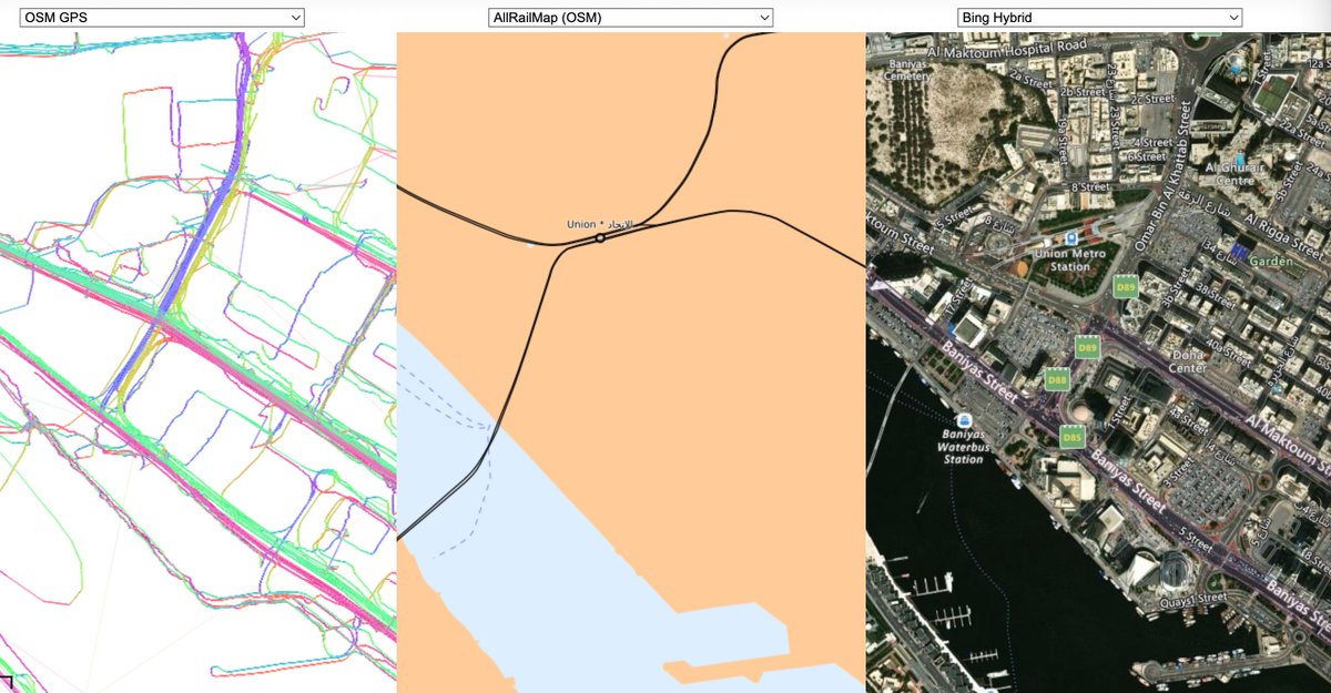
Map Compare shows you different maps:
mc.bbbike.org
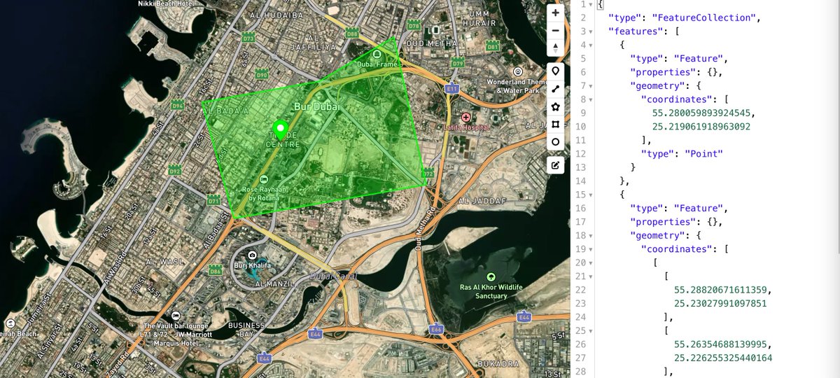
Get Json of Specific Location
geojson.io
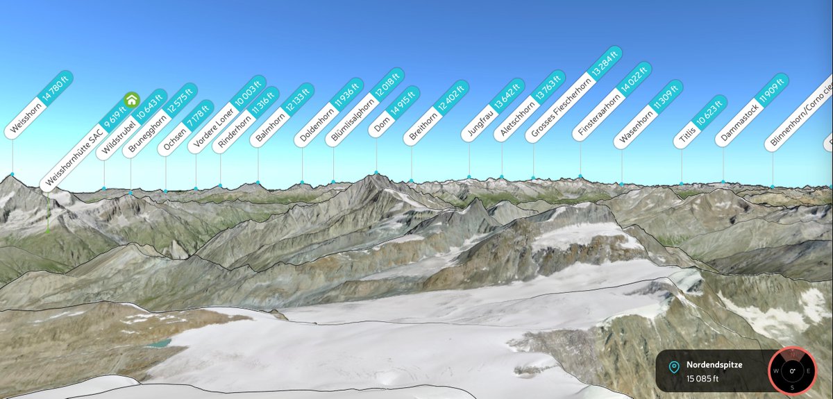
PeakVisor App
Navigate the world's mountains and natural areas with augmented reality, 3D map, peaks ID, hiking tr...
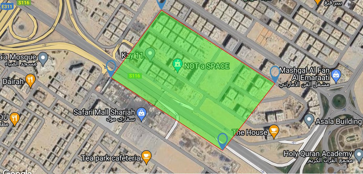
Free Map Tools
Free Map Tools
🗺 BBBike Map Compare 🛰
🗺 BBBike Map Compare shows you more than 270 maps from OpenStreetMap, Google, Bing, Esri, Here and o...

geojson.io | powered by Mapbox
A quick, simple tool for creating, viewing, and sharing spatial data.
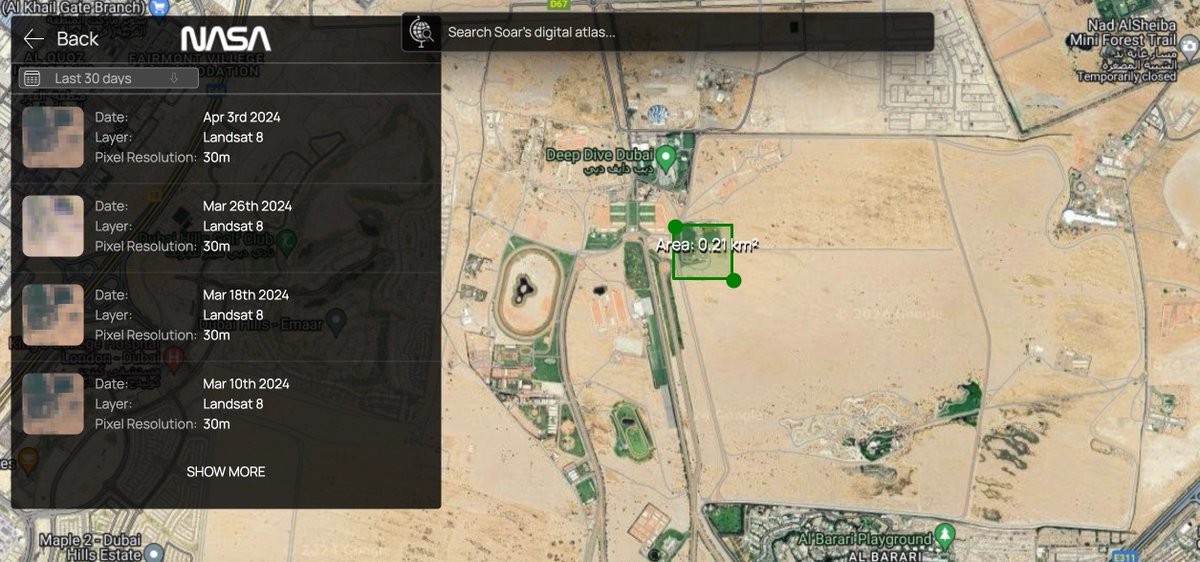
soar.earth
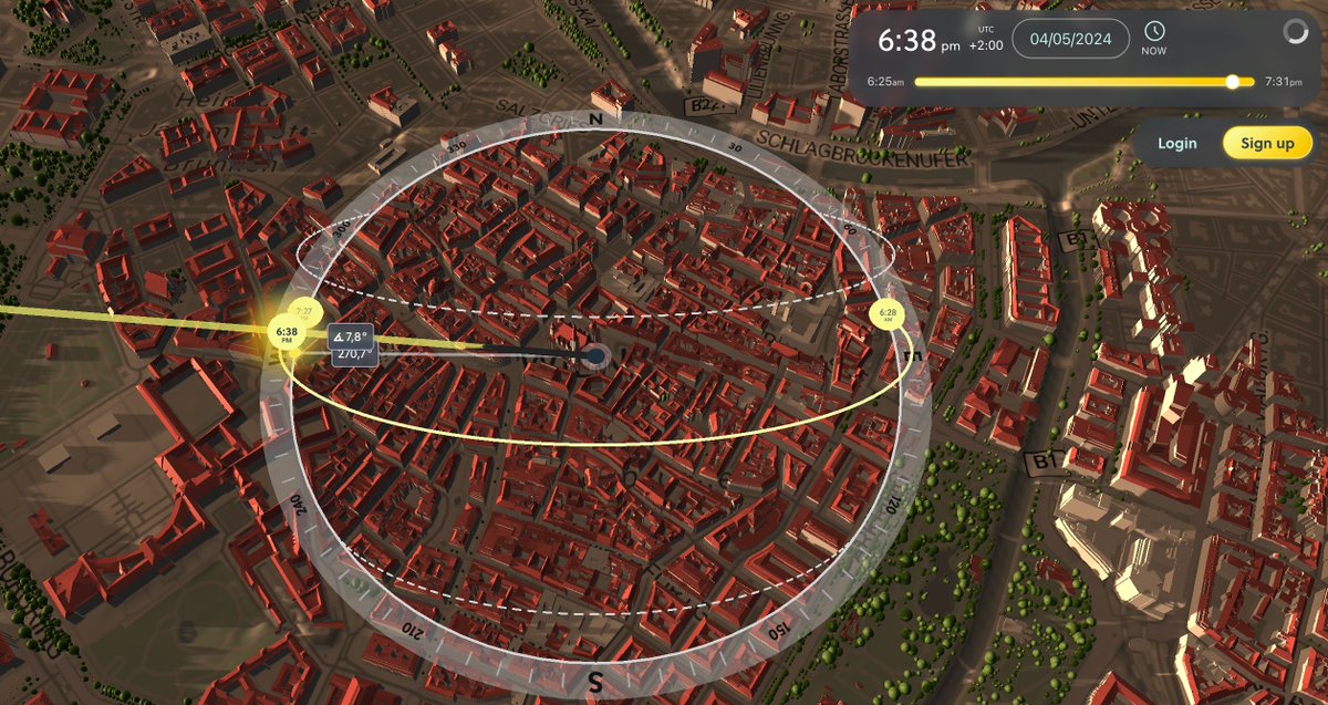
Computation path of the moon
mooncalc.org
Wind Directions
mapsm.com
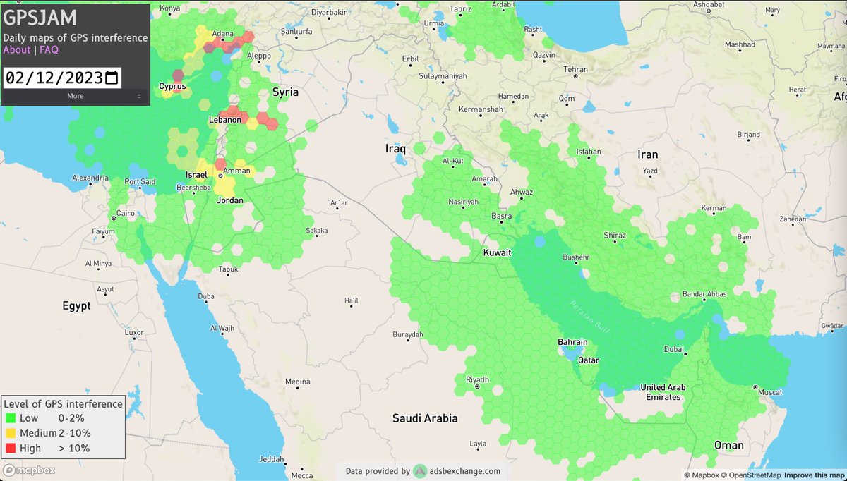
Daily maps of GPS interference
gpsjam.org
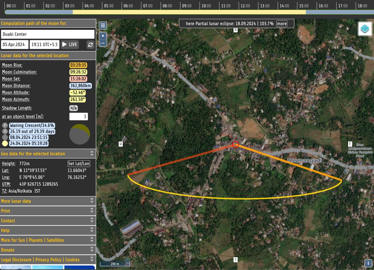


MoonCalc moon position- and moon phases calculator
Application for determining the moon curve at a desired time and place with interactive map.
Satellite Maps
Online View the 3D earth and Satellite Maps. navigate and explore the earth for Mapsm.

Soar — A digital atlas for the world's maps and imagery
Soar is a digital atlas of all the world's maps and imagery. Examples of content include satellite i...

GPSJAM GPS/GNSS Interference Map
Maps showing daily possible GPS interference.
apps.sentinel-hub.com
Query by Map
overpass-turbo.eu
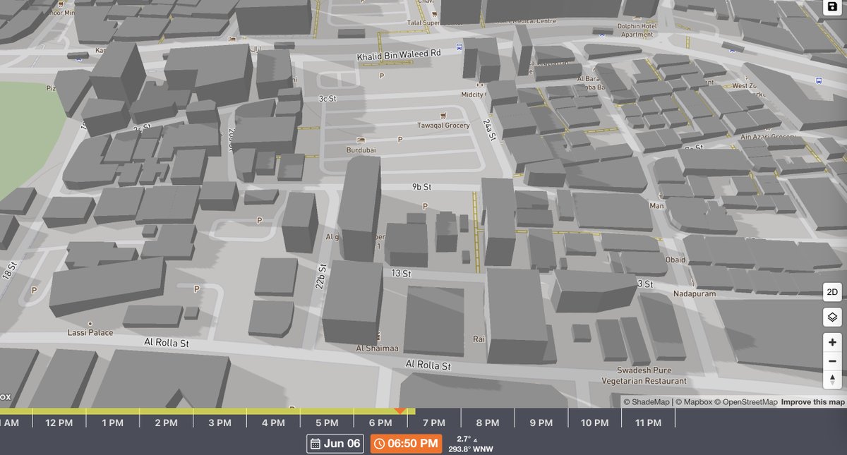
Simulate sun shadows for any time and place on Earth
app.shadowmap.org
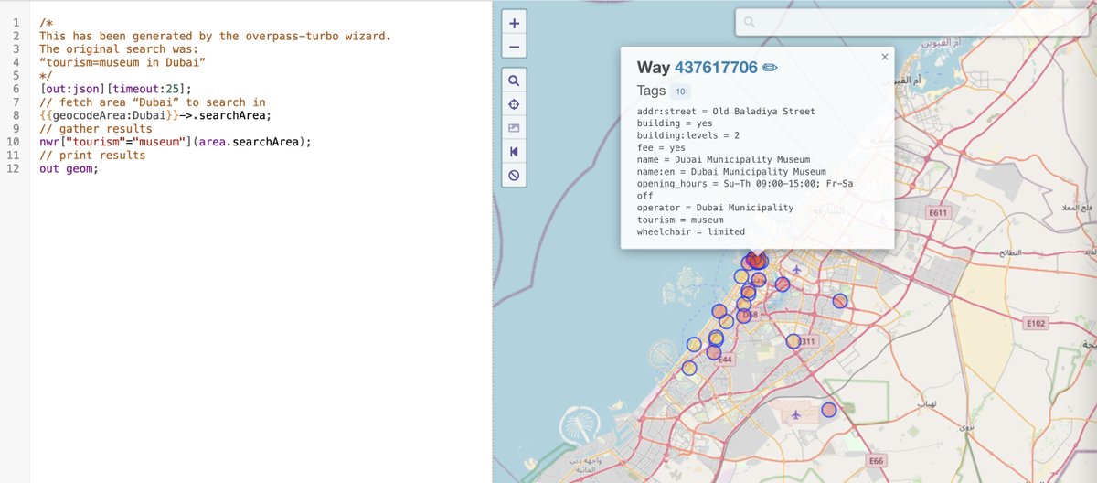

overpass turbo
A web based data mining tool for OpenStreetMap which runs any kind of Overpass API query and shows t...

Shadowmap | Sun-Powered Insights. Anywhere on Earth.
Your interface to the Sun: See the sunpath over your house. Visualize and analyze solar, architectur...

Sentinel-hub EO-Browser3
Sentinel-2 L2A imagery taken on August 18, 2018
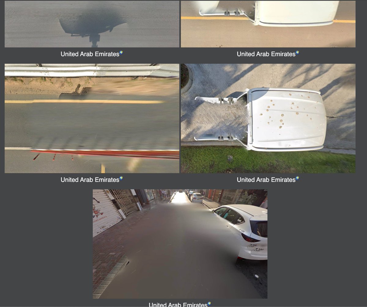
picarta.ai
labs.tib.eu
huggingface.co
geohints.com
Tools
docs.qgis.org
chromewebstore.google.com
googlelens.imagesniper.eu
Select a photo under "Image Selection" and estimate its geolocation by clicking on the world map. Un...
Kosmos 2 - a Hugging Face Space by ydshieh
Discover amazing ML apps made by the community
Find Photo Location Using Artificial Intelligence
Upload a photo and find out where it was taken. We will predict the photo location using AI
2. Foreword — QGIS Documentation documentation
QGIS 3.28 documentation: 2. Foreword

OpenSwitchMaps
Switch map services, and some useful links for OpenStreetMap contributors
GeoHints
FAQ The webpage is still in very early stages of development. If you have any tips/suggestions/bugs...
Google Reverse Image Search Fix
© 2023 Henk van Ess This tool finds exact matches in the image you're searching for, b ypassing Goog...
جاري تحميل الاقتراحات...